The best apps for Garmin Instinct 3
The best app for the Garmin Instinct 3 this week is Rain by VAW.BE ($2.49, score 8.4/10). A lightweight rain widget that shows a graph of the coming precipitation, faster than radar image widgets: the next hour in the USA, UK and Ireland, the next 2 hours in several European countries.
Apps, widgets, data fields and music apps that support the Instinct 3 (all sizes and editions), picked from our weekly ranking of the whole Connect IQ Store. Entries made for the Instinct 3, or for what it is built for, come first; after that the weekly score decides.

Rain
A lightweight rain widget that shows a graph of the coming precipitation, faster than radar image widgets: the next hour in the USA, UK and Ireland, the next 2 hours in several European countries.
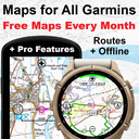
Awesome Maps (Free Topo Map & Routes + Offline)
Topo, satellite and national maps on your watch even without built-in map support, streamed from your phone, with route following and an offline mode. Includes many national map services worldwide.

RuckTrack — Rucking, Treadmill, Weighted Vest
Tracks rucking, weighted-vest walks and loaded hikes, indoors or out, and calculates calories with the Pandolf load-carriage equation from pack weight, speed, grade and surface. Pack weight, ruck calories and burn rate are saved to Garmin Connect.
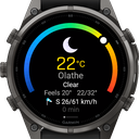
Atmos Weather
A weather app with an extended forecast: current weather, a 7-day forecast with detailed hourly data for each day and a 24-hour forecast with values you choose.
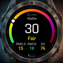
Atmos Air Quality
Air quality on your watch: the current EU or US air quality index, hourly and 5-day forecasts, and on newer watches dust, particle, visibility and pollen forecasts.

Maps4Garmin (Free) with Weather Radar (Paid)
Free live maps on your watch with no sign-up: see your location and browse the area around you. An optional yearly license adds a weather radar.
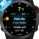
Open Weather Widget
A free widget that shows the current weather conditions from Open Weather Map. You need your own free API key from Open Weather; there is no forecast in this app.
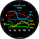
Weather Pro Widget
Hyper-local weather from Open Weather Map in a simple, colorful graphical display, updated hourly. The optional Pro version updates every 15 minutes and adds custom locations and more.

komoot
The komoot app for Garmin: plan routes with community recommendations, then find and navigate your planned tours on your watch in a few taps, with accurate way, surface and elevation info.

Walk With Frodo
Walk with Frodo and Sam to Mount Doom: your daily steps carry you 2,896 km (1,800 miles) along the journey, with 66 milestones from the books and movies and information about each place.
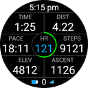
HikeField v2
An all-in-one data field for hiking and walking: a circle shows how much daylight you have left until sunset, plus many hike-related values. A revived and extended version of the original HikeField.
Peak Finder Compass
A live compass panorama: names of peaks and alpine huts float above the ridgeline as you face them, within 75 km anywhere in the world. Works offline with cached OpenStreetMap data and can navigate to a chosen peak.
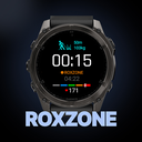
HYROX Tracker: ROXZONE
A dedicated HYROX app: a true race simulation on your wrist with running legs, station paces and transition times split cleanly in one saved activity. Plan your race on your phone; one-time purchase, no subscription.
Aviation Weather MB
Aviation weather on your watch for flight planning, such as airport reports and forecasts. Intended only as a planning aid, not for in-flight use or as a primary information source.

SunAlert: UV, Burn & Vitamin D
UV safety for your time outdoors: estimates the current UV level, how long until your skin may burn and how much vitamin D you get. For information only, not medical advice.

WHM breathing+
A breathing exercise tracker in the style of the Wim Hof method. The paid version adds a warning vibration before the end of breathing, detailed round info, adjustable vibrations and sounds, and a touchscreen lock.

ANT+ HRM Heart Rate Monitor
Connects an extra ANT+ heart rate monitor, shows its data and records it to the FIT file for comparison: heart rate, lap and session min, average and max, and zones.
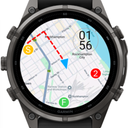
Activity Maps (BETA)
This is a BETA release for you to try. This data field will move to a paid app in future. Important note, your phone must be connected to the internet. Display Google or Open Topographic maps in your run/walk/bike activities.
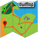
dwMap
An award-winning maps and routes app: create a route on your phone or laptop, send it to your watch and navigate it without a data connection. All described features are free; premium adds more.
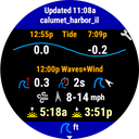
Tides
A widget with tide times and heights plus wave and wind forecasts for the nearest station or one you pick, with sunrise and sunset. The data stays available offline. The free version shows 12 hours; Pro shows 5 days and accepts custom coordinates.
Scores 0–10 from description, rating, popularity, recent reviews, care, reach and originality; template series and duplicate trial editions are filtered out. How we rate →